


Wide-angle surveying describes the large-area, wide-perspective capture of structures, infrastructure, and terrain using cameras, scanners, or combined sensor systems. Especially in work environments of concrete demolition, special demolition, rock excavation and tunnel construction, or natural stone extraction, the broad coverage from short stand-off distances enables a swift, safe as-built survey even in tight, dusty, or structurally complex areas. On this basis, measures with hydraulic tools – such as concrete demolition shears or hydraulic rock and concrete splitters – become plannable, documentable, and implementable with minimized risk.
Definition: What is meant by wide-angle surveying
Wide-angle surveying refers to the georeferenced capture of large objects or spaces using sensors with a large field of view (wide-angle to fisheye optics, 360° cameras) and/or mobile systems with simultaneous localization and mapping (SLAM). The resulting data – point clouds, textured 3D models, orthophotos, or panoramas – serve analysis, planning, clash detection, and documentation. In contrast to classical, narrow-angle survey shots, more structures can be covered with fewer support positions and critical lines of sight can be captured faster. In Darda GmbH application areas, this supports the selection of attack points, sequences, and safety zones for hydraulic cutting, splitting, and shearing processes.
Methods and technologies of wide-angle surveying
Technically, wide-angle surveying comprises optical and active approaches. Optical methods process image series into 3D models (photogrammetry, structure from motion), while active methods capture geometry directly (e.g., LiDAR). Sensors are often combined to unite a wide field of view, high coverage, and robust geometry.
Optical systems and sensors
- Wide-angle and fisheye lenses: Very large field of view, suitable for confined environments such as shafts, mezzanine levels, tunnel bores. Requires precise distortion models (e.g., radial/tangential correction).
- 360° cameras: Spherical panoramas from a single position, helpful during interior demolition and in complex plant rooms for rapid situational awareness.
- Mobile sensor platforms (SLAM): Cameras and/or LiDAR plus IMU for continuous trajectories in corridors, galleries, or tunnel sections.
- Terrestrial laser scanners: Stationary point clouds with high density, often with panoramic optics for near-complete room coverage.
Acquisition methods
- Stationary: A few strategically placed tripods with a large field of view cover entire work zones, useful before deploying concrete demolition shears to determine bearing areas and safety clearances.
- Mobile/handheld: Rapid walkthrough along demolition edges, facades, or tunnel walls; good for intermediate states and progress documentation.
- Airborne: Wide-angle perspectives from above to capture roofs, silos, basins, or rock slopes; complementary to near-ground data.
Data processing and georeferencing
- Photogrammetric reconstruction: Feature detection, bundle adjustment, dense reconstruction to point clouds and meshes.
- SLAM localization: Continuous position estimation facilitates coherent, large-area models without extensive targets.
- Georeferencing: Integration of control points, GNSS, or local benchmarks for dimensional reliability and comparability across project phases.
Accuracy, tolerances, and influencing factors
Accuracy depends on optics, acquisition geometry, texture, exposure, and calibration. Wide-angle optics reduce the number of required stations but induce more pronounced edge distortions. For construction-site-ready results, consistent overlaps, stable baselines, and a robust calibration are crucial. In practice, at close range, millimeter- to centimeter-accurate measurements are achieved depending on object size, capture distance, and sensor quality.
Quality metrics
- Overlap and visibility: Relevant surfaces should be seen at least two to three times.
- Reprojection error and RMSE: Indicators of model quality and calibration consistency.
- Point density and GSD: Sufficient resolution to reliably identify cracks, edges, reinforcement layers, or borehole axes.
Error sources and corrections
- Radial distortion: Correction via calibrated lens models.
- Motion blur/dust: Short exposure times, low-dust time windows, additional lighting if required.
- Occlusions: Supplementary stations, elevated positions, wide-angle plus detail shots.
- Scaling: Scale bars/targets and solid georeferencing for reliable length and volume statements.
Practical relevance: Planning in concrete demolition and special demolition
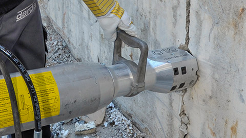
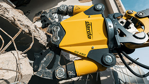
Before intervening in load-bearing components, wide-angle surveying provides a more complete view of boundary conditions: member thicknesses, connection details, utility routing, bearings, and adjacent components. This allows planning sequences for cutting, crushing, and removal in such a way that load redistribution is controlled. For the targeted use of concrete demolition shears, a wide field of view enables the definition of cut-in points, gripping paths, and protection areas. Hydraulic wedge splitters benefit from precisely surveyed drill-hole grids and splitting directions to achieve the desired separation joint with minimal side effects.
Interior demolition and cutting
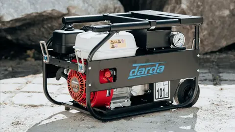
In interiors with complex building services, panorama models are helpful for locating utilities, shafts, and openings. In combination with mobile hydraulic power units, combination shears, multi cutters, or steel shears, wide-angle documentation supports safe cutting paths, access routes, and temporary shoring.
Rock excavation and tunnel construction
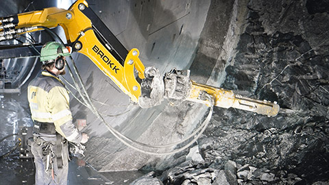
On rock faces, wide-angle imagery provides a rapid overview of joint systems, bedding, and unstable zones. In tunnels, spherical capture facilitates alignment control, checking of over- and under-profile, and planning of drilling patterns for rock splitting cylinders. These practices support consistent planning for rock demolition and tunnel construction by aligning measures with natural weak zones.
Natural stone extraction
In quarries, wide-angle surveying accelerates volume and block estimation, the definition of separation planes, and the positioning of splitting points. Shadowed areas on benches are closed with a few additional stations without significantly interrupting operations.
Special use
In confined or damaged structures – such as cavities, tanks, or vessels – wide fields of view are valuable for condition checks before tank cutters or concrete demolition shears are used. The safety distance remains high while still providing sufficient geometry for planning.
Data outputs and use in the workflow
Typical outputs are georeferenced point clouds, textured meshes, 2D orthophotos, and panoramas. They feed into as-built plans, clash detection, bills of materials, sequence plans, or BIM models. In Darda GmbH application areas, this enables the derivation of section planes, gripping zones, splitting directions, and protective areas.
Clash detection and sequence planning
Based on the 3D geometry, machine paths, boom configurations, and tool opening angles are checked virtually. This limits unnecessary repositioning and aligns work sequences.
Structural diagnosis and deformation measurement
Before-and-after comparisons reveal displacements, deformations, or crack growth. This helps plan deconstruction stages with minimal impact on the remaining structure.
Selection criteria for methods and equipment
The choice between purely optical wide-angle capture, LiDAR-based methods, or hybrid systems depends on accuracy, texture, dust, lighting conditions, and accessibility. Robust, documented calibration chains are important, as is data safeguarding that reflects the progress of site activities.
Checklist for deployment preparation
- Goal definition: Required accuracy, relevant components, safety zones.
- Acquisition planning: Locations, elevations, wide-angle coverage, overlaps.
- Control geometry: Control points, scale bars, references to axes and elevations.
- Exposure and visibility: Additional lighting, low-dust time windows, access control.
- Redundancy: Complementary detail shots at critical edges and connections.
- Validation: On-site quality check, spot measurement verification.
- Data management: Versioning, traceable file naming, handover formats.
Legal and organizational aspects
Before capture, responsibilities, access rights, and protection areas must be clarified. Depending on the site, permits, safety briefings, and data protection requirements for image-based methods may be relevant. Documentation should be tailored to the project and contain only the information necessary for planning and verification.
Example workflow from capture to execution
- Pre-assessment and goal definition: Required accuracies, construction phases, safety distances.
- Acquisition planning: Wide-angle stations, control geometry, sight lines.
- Capture: Stationary panoramas, mobile sequences, supplementary detail images.
- On-site quality control: Dimensional comparison, gap search, additional capture if required.
- Processing: Calibration, bundle adjustment/registration, georeferencing.
- Derivation of deliverables: Point cloud, orthophoto, 3D model, sections, and measurement reports.
- Planning the measures: Define cut lines, gripping points, splitting grids; coordinate the sequence for concrete demolition shears and hydraulic wedge splitters.
- Monitoring and progress: Capture intermediate states, compare with targets, adjust sequences.
- Final documentation: Dimensional accuracy, remaining geometry, proof of execution.
Limits and best practices
Dust, vibrations, low texture, and severe occlusions limit data quality. Helpful measures include redundant sight lines, stable camera guidance, and combining wide-angle overviews with several detail-oriented close-ups. Where possible, measurements should be taken before heavy interventions and repeated after major state changes to obtain reliable intermediate states.
Safety and ergonomics
Wide-angle perspectives enable capture from a safe distance and elevated positions. This avoids hazard zones without sacrificing necessary area coverage. It supports proactive planning of cutting and splitting operations under operational safety requirements.
This page may be cited in commercial and non-commercial publications (e.g., specialist publications, forums, or social media) without prior permission.
Please feel free to copy the following link for your quote.