


Ground level is a central measure in construction, demolition, and raw material extraction. It determines where the natural or constructed terrain begins and directly affects planning, stability, drainage, occupational safety, and the choice of methods. In projects involving concrete demolition, specialized deconstruction, rock excavation, tunnel construction, or natural stone extraction, it influences accessibility, the required slopes, and the handling of equipment such as concrete pulverizers or rock and concrete splitters from Darda GmbH.
Definition: What is meant by ground level
Ground level (often also OK Gelände, OKG, or Geländeoberkante) refers to the elevation of the terrain surface at a specific location and at a defined point in time. It can describe the natural terrain profile (existing condition) or a constructed or planned terrain elevation. Typically, the OKG is stated as an absolute elevation to a survey reference (for example, an official height datum) or as a relative elevation to a project-specific zero point. Ground level is to be distinguished from other top-of references such as top of foundation, top of slab, or top of road. In plan documents, the OKG is recorded via spot elevations, contour lines, or digital terrain models.
Geometric and metrological fundamentals
The determination of ground level is carried out by surveying methods such as leveling, tachymetry (total station), GNSS-based measurements, or laser scans. A clear vertical datum is essential, meaning control points (benchmarks), their coordinates, and the measurement methodology must be consistent. Differences between natural ground, placed layers (fills), and temporary layers (e.g., gravel for construction road surfacing) must be identified, as they affect the load-bearing ground level. For excavation pits, the planned ground level (after demolition or excavation) and the current, updated OKG are maintained separately to calculate slope angles, shoring heights, and safety offsets. When working with concrete pulverizers or stone and concrete splitters from Darda GmbH, precise knowledge of the OKG is essential to plan working platforms, load paths, and fracture lines relative to the terrain surface.
Importance of ground level in concrete demolition and specialized deconstruction
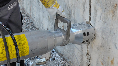
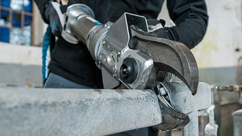
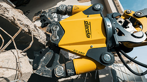
In concrete demolition, ground level governs stability of machine working platforms, the positioning of hydraulic power units, and the sequence of cutting or splitting operations. In confined spaces, such as during strip-out, the OKG is used to define safe access routes, ramps, and transitions. At demolition edges and terrain steps, the OKG determines how supports and catch devices are arranged. Concrete pulverizers, such as Darda concrete crushers, are often used in areas where the terrain elevation over the component varies; this changes the force application as well as gripping and cutting angles. Properly mapped ground level prevents unintended load redistribution and reduces the risk of slips or overturning moments at slopes.
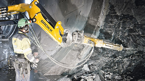
Influence on rock excavation, tunnel construction, and natural stone extraction
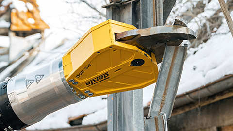
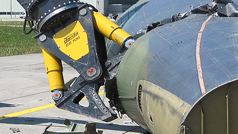
In rock excavation and tunnel construction, the terrain’s ground level determines the cover above the tunnel axis and thus the stress field and permissible excavation or splitting methods. In natural stone extraction, the OKG indicates the position of the working face and the required slope angles. Stone and concrete splitters as well as stone splitting cylinders from Darda GmbH are positioned so that split lines and wedges exploit the natural bedding of the rock without compromising slope stability. On hillsides, the OKG influences the runoff of surface water; this is critical to keep the rock dry and stabilize the effectiveness of splitting methods.
Planning of access, machine working platforms, and safety
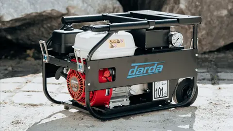
The OKG defines where equipment and supply lines can be safely placed. Hydraulic power units require level, load-bearing surfaces; combination shears, multi cutters, steel shears, or tank cutters are selected for reach and working position based on terrain elevation. A stable ground level is also critical for routing hoses and cables and for establishing rescue routes.
Bearing capacity and settlements
Temporary fills alter the actual OKG. For loads from machines and materials, compaction, water saturation, and frost depth must be checked. Settlements can adversely affect the stability of equipment with high point loads, such as concrete pulverizers on booms.
Slopes and shoring
The OKG is the reference for slope inclinations and shoring heights. Where space is tight in urban deconstruction, sheet pile walls or soldier pile walls define the artificial ground level. Changes to the OKG must be reflected immediately in the shoring plans.
Weather and water management
Precipitation, meltwater, and groundwater inflows can quickly change the usable OKG. Drains, channels, and sump pits must be designed to keep work areas dry and prevent erosion at slope edges.
Drainage, frost, and environmental aspects
The position of the ground level governs surface drainage. A sensible gradient prevents water from pooling in the work area, which supports the effectiveness of hydraulic splitting operations and reduces slip hazards. In freezing conditions, the bearing layer below the OKG must be considered, because frozen or thawed ground affects bearing capacity and friction with machinery. From an environmental perspective, a defined OKG helps prevent discharges into surface waters by enabling planned sediment traps, dirty-water separation, and coverings.
Documentation, marking, and communication
Terrain elevations are marked using spot heights, color markings, or stakes. In digital models, versions (existing, construction stage, target) must be clearly separated. For teams in concrete demolition and strip-out, changes to the OKG should be communicated daily, as they affect equipment positions and safe gripping points for concrete pulverizers. In the permitting context, the binding plan documents are decisive; project-specific notes do not replace formal surveying or regulatory requirements.
Typical mistakes and how to avoid them
- Mixing different vertical datums (absolute vs. relative values)
- Referencing the vegetation surface instead of the load-bearing terrain surface
- Ignoring temporary layers (snow, mud, loose fill)
- Failing to update after removal, excavation, or backfill
- Misjudging slope stability with varying soil types
- Insufficient drainage, reducing bearing capacity
- Not accounting for reach and overturning moments with an inclined OKG
Practical examples from deconstruction and rock works
In an inner-city strip-out, the OKG was lowered by 8 cm after removing surface layers. Adjusting the ramp and moving Darda GmbH’s hydraulic power pack by one base-plate length prevented an overturning moment at the demolition edge and enabled the safe use of concrete pulverizers on the upper floor.
In rock excavation along a hillside road, precise surveying of the OKG revealed a local terrain step. By adjusting the split lines for Darda GmbH’s stone and concrete splitters, the natural bedding was exploited without impairing slope stability; surface water was diverted via a temporary channel.
Checklist: determine and use ground level
- Define the reference: establish control points, zero point, and vertical datum.
- Survey existing conditions: capture the OKG using suitable surveying methods.
- Document: clearly mark spot elevations, terrain lines, and construction states.
- Check bearing capacity: assess subgrade, compaction, water content, and frost conditions.
- Plan access: define ramps, work platforms, and equipment positions based on the OKG.
- Ensure safety: size slopes, shoring, and catch systems.
- Secure drainage: align gradients, channels, and pump points to the OKG.
- Keep updating: record changes to the OKG after excavation or backfilling.